
The Tybee Island Natural Infrastructure Master Plan aims to help the island better absorb and recover from more frequent storms and flooding caused by rising, warming seas.
Project Lead: Alan Robertson, AWR Strategic Consulting, awrstrategic@gmail.com
Partners: University of Georgia’s College of Agricultural and Environmental Sciences, College of Engineering, College of Environment and Design, Institute for Resilience Infrastructure Systems, Marine Extension and Georgia Sea Grant and Skidaway Institute of Oceanography
Funding: $300,000 from the National Fish and Wildlife Foundation (NFWF) and Georgia Department of Community Affairs
Project Summary:
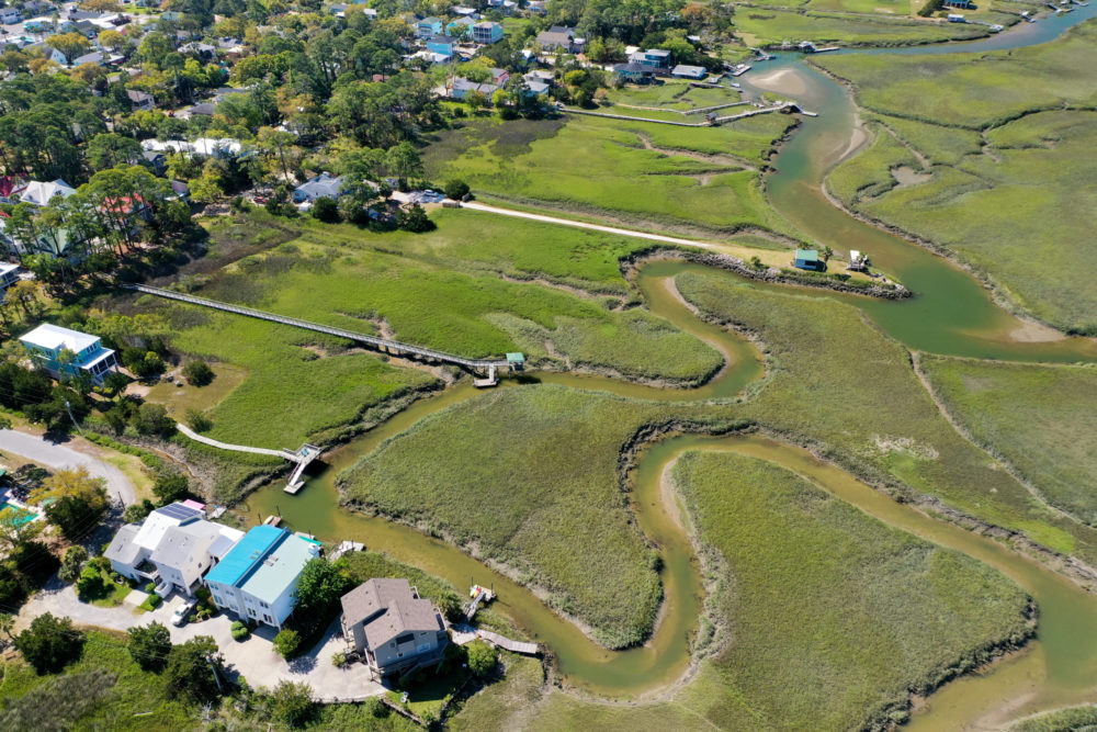
Developed in partnership with the University of Georgia, the Tybee Island Natural Infrastructure Master Plan outlines a proposed integrated and community-centered system, which utilizes natural elements to provide increased resilience to flooding while protecting natural habitat and enhancing the quality of life.
The plan assesses flood risks and solutions, focusing on areas that border Tybee Island’s marsh shoreline. The plan also considers the risks of doing nothing and the subsequent impact on natural habitats, properties, and vital infrastructure. The design process engaged over 525 residents and local partners, 83 college students, and 120 volunteers.
The plan recommends the implementation of several nature-based features including rain gardens, living shorelines, and permeable pavers. These recommendations would capture and filter 21 percent of the total stormwater runoff that otherwise would have drained into the marsh.
Project Goals:
- Provide increased resilience to flooding on Tybee Island
- Preserve and restore fish and wildlife habitat
- Improve connectivity throughout the island
- Align with community values
- Consider cost and time to implement
- Recognize regulatory requirements and constraints